
GPS map camera for iPhone
Geoplate puts the place on the photo: the street address, GPS coordinates and a mini map with a pin, printed next to the date and time. The location comes from your iPhone's GPS while you shoot, and the coordinates work even with no signal.
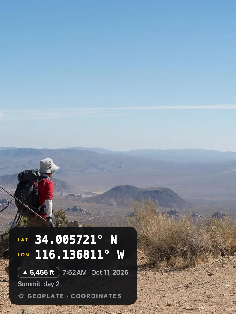
A place you can see
A photo of a wall, a meter or a stretch of road looks the same anywhere. A printed address and a small map say where it is without a word of explanation.
Coordinates go further where there is no street address: a field, a trail, a creek or a utility pole.
How it works
Allow location
Geoplate uses your location only while the app is open. Precise location gives the exact building.
Check the pin
Wrong address? Search for it, move the pin on the map or type it in yourself.
Shoot
The address, coordinates and map are printed into the photo.
Location fields
- Street address, found with Apple Maps
- Mini map with a pin, standard or satellite
- Coordinates: decimal, degrees and decimal minutes, DMS, UTM or MGRS
- Altitude, metric or imperial
- Compass heading and speed
- Location accuracy
No signal?
The address and the map need a connection. Offline, the camera still stamps the date, time and coordinates, and you can add the address later in the app.
Who uses it
Questions
Does the GPS map camera work offline?
Partly. Coordinates come from GPS and work without a connection. The street address and the map need the internet, so offline photos get coordinates only.
What if the address is wrong?
Search for the right address, pick a nearby place, move the pin on the map or type the address yourself before or after the shot.
Which coordinate formats are there?
Decimal degrees, degrees and decimal minutes, degrees minutes seconds, UTM and MGRS.
Does Geoplate track my location?
No. It reads your location only while the app is open, to put it on the stamp. Your photos stay on your iPhone.